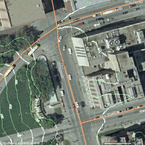
Above is a contour map of the relevant part of Houston Street. (The aerial view - complete with contours - was obtained from dfwmaps.com). The contour lines, which I have enhanced to make them clearer, are at 2 foot intervals. Houston is thus globally flat, and since it is a main highway, presumably it is also locally flat, except for a 'hump' at the Houston - Elm junction.